Skip to content
MetroList Information Center
  • Home
  • Training Calendar
  • Prospector +
  • Products
  • Forms & Documents
  • MLS Rules
  • Help Center
  • Contact

MLS Area Maps and Definitions

MetroList has digitized its MLS Area Maps. The online geo-coded maps provide MetroList Subscribers the ability to accurately place their listings in the correct property area. Through the use of mapping software, listings are placed in MLS areas based on the longitude and latitude of the listed property.
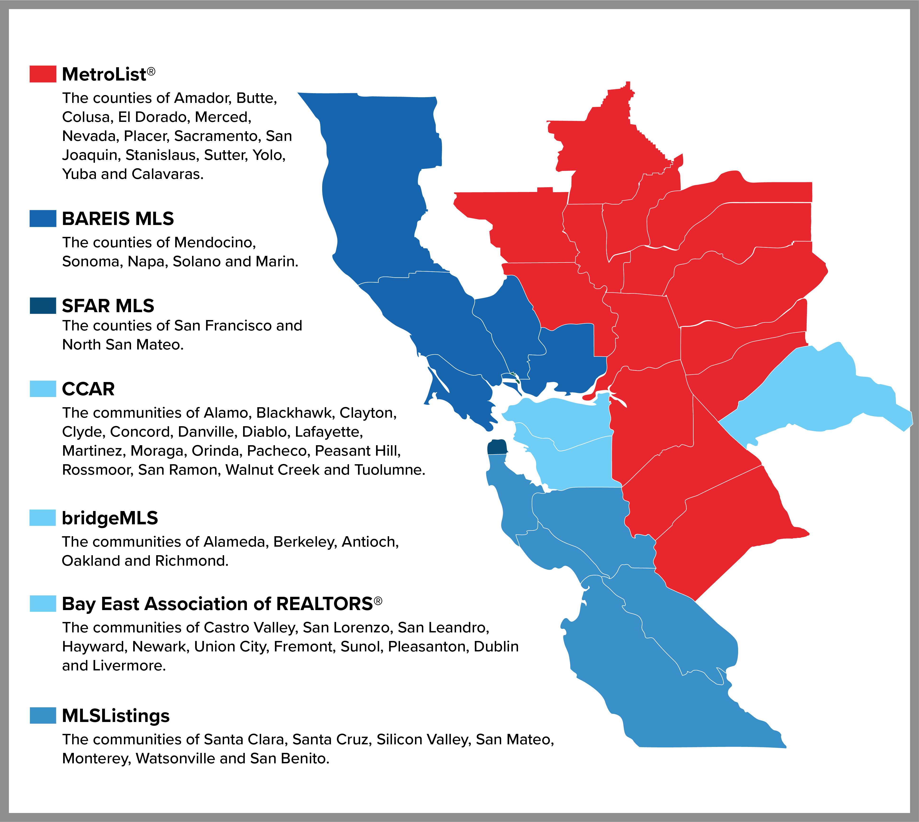
Area maps for BAREIS and SFAR Expand

BAREIS MLS Areas

SFAR Map

All MetroList Counties Expand

All MetroList County Area Definitions

Amador County Expand
  • Amador County Area Map
  • Amador County Area Definition
El Dorado County Expand
  • El Dorado County Area Map
  • El Dorado County Area Definitions
Merced County Expand
  • Merced County Area Map
  • Merced County Area Definitions 
Nevada County Expand
  • Nevada County Area Map
  • Nevada County Area Definitions
Placer County Expand
  • Placer County Area Map
  • Placer County Area Definitions
Sacramento County Expand
  • Sacramento County Area Map
  • Sacramento County Area Definitions
San Joaquin County Expand
  • San Joaquin County Area Map
  • San Joaquin County Area Definitions
Stanislaus County Expand
  • Stanislaus County Area Map
  • Stanislaus County Area Definitions
Sutter County Expand
  • Sutter County Area Map
  • Sutter County Area Definitions
Yolo County Expand
  • Yolo County Area Map
  • Yolo County Area Definitions 
Yuba County Expand
  • Yuba County Area Map
  • Yuba County Area Definitions
MIC - MLS Areas Key

Technical Support
916-922-7584 or 888-898-9788; Option 2
M-F: 7:30am-6pm | Sat-Sun: 9am-3pm

©2025 MetroList Services, Inc. All rights reserved.